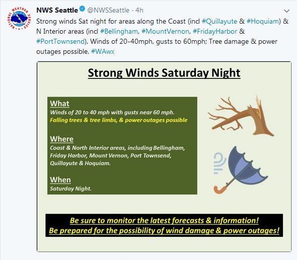
Looks like we have some weather coming our way Saturday night into Sunday morning. The NWS has issued a "High Wind Watch" for Admiralty Inlet. Technically, we are not in that zone, but we have front row seats.... At this point, it does not look like a major wind event for us, but just enough where we may want to have fresh gas in the generators.... Here is the text from the NWS:
...HIGH WIND WATCH IN EFFECT FROM SATURDAY EVENING THROUGH SUNDAY
MORNING...
The National Weather Service in Seattle has issued a High Wind Watch, which is in effect from Saturday evening through Sunday morning.
* WIND...Southeast wind 20 to 40 mph with gusts as high as 60 mph are possible.
* SOME AFFECTED LOCATIONS...Whidbey Island, Camano Island, Port Townsend, the San Juan Islands, Anacortes, Mount Vernon, Bellingham, Cherry Point, and Ferndale.
* TIMING...Winds will increase on Saturday evening then peak early Sunday morning. Winds will start to ease soon after sunrise on Sunday.
* IMPACTS...Tree damage and some power outages are possible. Be careful for the hazard of falling trees, especially if driving during nighttime hours on Saturday night and early Sunday morning.
In case you missed the sunset last night (1/18).... Here is what came out of nowhere and lasted about 2 minutes....

No comments:
Post a Comment