I have some tools on my site that I thought I would share in this blog. The first is the CAPE Forecast tool. This is down in the "National Weather Service" section. CAPE is an acronym that stands for "Convective Available Potential Energy". The weather service can measure the amount of energy an air particle would have if it was lifted in the atmosphere. If it creates enough energy, it results in lightning.
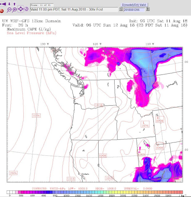
When you click on the "CAPE Forecast" link, you will get an interactive screen that looks like this. You can see it is for 8:00am today. The pink off the coast is potential lightning. These forecasts are in 3 hour increments. I will share the forecasts for today below:
11:00am - You can see the potential starting to move into Puget Sound
2:00PM - You can see it has us covered and a new color is introduced.... This is a higher potential.
5:00PM - It pretty much has saturated our area.
8:00PM - Still pretty solid, but starting to lighten up.
11:00PM - It finally starts to clear up....
So, we could have some interesting weather today. There is one more tool to share from the site. It is an interactive lightning map that shows where lightning has struck. The link is right below the CAPE Forecast link. Here is a direct link to that site: Lightning Map
Be Safe Today!


No comments:
Post a Comment